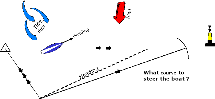
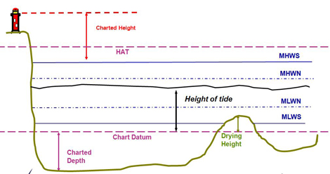
Navigation SheetCompass (C)+/- Deviation = Magnetic (M)+/- Variation= True (T)+/- Leeway= Water Track (WT, >)Tidal Streams (>>>)= Ground Track (GT, >>)Rule: C ADE T (Compass to true add east) Course to SteerWhat is the compass course to steer to a waypoint?Course+/- Variation+/- Leeway+/- Deviation= Course to SteerWhat is the ETA at the waypoint?(Distance to WPT / SOG) x 60(AB / AD) x 60 Tidal Heights